The Clover paths in Øster Hornum
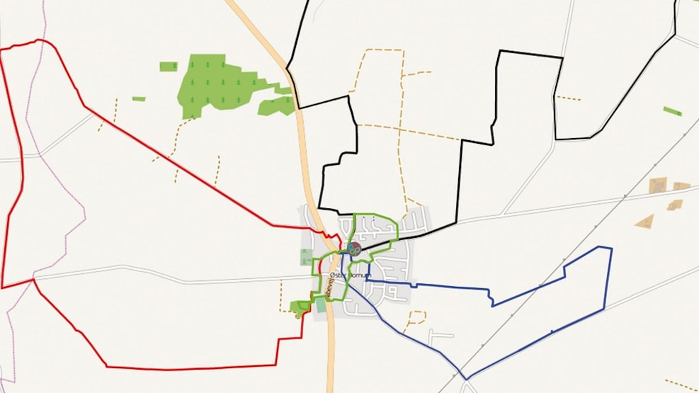
The four paths in Skørping will take you on remarkable and pretty paths. At this site, you can see a short description of the four routes, as the brochures and maps are only provided in Danish. All routes starts at the either the sports centre in Øster Hornum here, or in the centre of Øster Hornum here.
You can find the Clover path map here.
Green route (2.7 km)
The green route is the town path in Øster Hornum. On this path, you will pass 5 information boards, which will inform you about the history of the town. These boards only inform about a part of the town history because the town history is too extensive for it all to be written.
The town is under development with the new health center, renovated school, new kindergarten, the new cloverpaths, new building site, and the new outdoor center Katbakken. You will pass by these locations on this route.
For further information about the history, visit the local archive in Øster Hornum in their opening hours. (Birkehøjvej 8, Øster Hornum, 9530 Støvring)
Blue route (5.4 km)
This path follows old wheel tracks and property boundaries in a farming area, which though time have developed from small lots to large fields. The areas is well qualified for extraction of raw materials because sand and gravel are underneath the fields. You will pass by an area which were primarily heath until 1900. From 1900 until 1940, the area was ploughed, and since then has been used to traditional farm crop. You will also pass by Øster Hornum Waterwork. In the middle of the path is the ancient mound, Tinghøj, where trials were held until 1688. In the area around the mound, there have been found graves and evidence of housing from the Iron Age.
Red route (8.1 km)
This route will pass by the outdoor center Katbakken, and to the old dike that separated the priest’s residence and the land, Abildgård. From here, you walk towards the mounds Nihøje, but you will also pass a marked detour that can take you to Stodshøj, where you can experience a wonderful 360 degrees view.
If you do not take the detour, you will walk along Harrildgårdsvej, where you can still experience landscapes as it was during the Iron Age, which consisted of pasture, bog, meadow, small forests, small villages and fields. You walk along Frendrup Meadow where you can still see traces of the old roads, and these areas are now protected.
You will also pass a creek that used to function as the dividing line between the two parishes Vokslev and Øster Hornum. When you reach the mounds Nihøje, you will see a cup-marked stone from the Bronze Age. Other traces after flint stone tools can be found from time to time. From the mounds, you will have a great view, and it is recommended that you bring a pair of binoculars. Hereafter, the path takes you to the start of the route.
Black route (11.3 km)
The first part of the route will take you to the town pond. During World War I, a small water power station was installed, and it could supply the town with power for a couple of hours every night. However, in 1924, the station was shut down because the town was connected to electricity network. The area is now a small park with a pond. The water in the town pond is from the many springs in the town, and is connected to Hasseris Å. Hasseris Å is a creak that has supplied many watermills with water power. North of the town pond, a poorhouse used to be located until the mid-1960s.